ECT and ENSP at the Biennale d’Architecture et de Paysage (BAP)

ECT IS A PARTNER OF THE BAP ! 2022 « LAND AND CITIES »


Biennale d'architecture et de paysage de Versailles

The subject of « Land and Cities » that challenges ECT

The Architecture and Landscape Biennial (BAP) launched its first edition in 2019, « Man, Nature and the City », which attracted 200,000 visitors. Still organised by the Ile-de-France Region and the City of Versailles, the 2nd edition of the BAP was held from 14 May to 13 July 2022. The link between « land and cities » was considered with 10 exhibitions in prestigious locations. The proposed itinerary combined the views of professionals, artists and the Versailles schools of Architecture and Landscape.

A rich and future-oriented programme

ECT is proud to have partnered with this important event. And is involved in various exhibitions in various degrees of partnership.

« Project(s) Earth(s) » at the National School of Landscape Versailles

In this exhibition, the National School of Landscape gives visitors the opportunity to put themselves in the shoes of the landscape students who are learning how to « care for soils » in landscape projects. In the enchanting setting of the “Potager du Roi” (king’s kitchen garden), the curator, Emma Morillon presents the work carried out by the students and the workshops organised by the school on the reuse of excavated soil. This exhibition is part of the activities of the chair  » Earth and landscape « , a partnership between the ENSP and ECT.

Biennale d'architecture et de paysage de Versailles

« Visible / Invisible » at the National School of Architecture Versailles

« Visible / Invisible » questions the contemporary architectural forms that can arise from the rediscovery of the materials and the rational use of land energy. This exhibition is curated by Guillaume Ramilien and Nicolas Dorval-Bory. The courtyard of the School of Architecture is filled with silt, sand, marl and clay. This is soil brought back from the Villeneuve-sous-Dammartin site and excavated from the subsoil of the Ile-de-France region by the public works sector. This installation is the subject of a sponsorship between ECT and the School of Architecture.

Biennale d'architecture et de paysage de Versailles

« La Tour des Terres” (the layers of the earth), a manifesto for a promising land !

Created by MueExperiences, this 60 cm module made of raw clay takes a prominent place in the Visible/Invisible exhibition. The tower demonstrates the load-bearing capacities of the earth through the experimentation of different construction techniques in raw earth, heavy clay, cob, light earth and plaster. ECT is proud to have contributed to its creation.

Le Potager du roi

The Potager du Roi at Versailles

The Pavillon de la Métropole du Grand Paris, designed by Chartier-Dalix, hosts a photo exhibition by Anne-Marie Filaire

Facing the Château de Versailles, The Pavillon de la Métropole du Grand Paris is an innovative building designed by the Chartier-Dalix agency. The ‘biodiverse’ wall is a structure that is both a solid load-bearing wall and a vertical floor, inhabited by flora and fauna. A world’s first! The pavilion hosts a photo exhibition by Anne-Marie Filaire, the result of her work on various ECT land reclamation sites. A perfect match between stone and earth.

Biennale d'architecture et de paysage de Versailles

« Elément terre », an exhibition of the Paris Region Institute

Elément Terre, curated by Cécile Diguet, presents a very impressive model of the Ile-de-France region, made from the soil of the region. With the theme, « the earth that shapes us – the earth that we shape », the exhibition also presented the project  » Cycle Terre » with a raw earth wall and photographs by Pierre-YvesBrunaud. This comprehensive exhibition evoked the subsoil of Ile-de-France, illustrated by a sample taken from an ECT site.

Biennale d'architecture et de paysage de Versailles

THE « EARTH MOVING » (« TERRES EN MOUVEMENT ») EXHIBITION WITH THE ENSP

The "Earth Moving" ("Terres en mouvement") exhibition was the first product of the business chair "Earth and Landscape", which is itself the result of a partnership between ECT and the French national landscaping school, the ENSP or École Nationale Supérieure de Paysage at Versailles.

This exhibition, with the evocative sub-title of "An examination of 'made ground' landscapes in the Île-de-France", was held in the prestigious setting of the La Figuerie in the Potager du Roi at Versailles, during BAP! (the Biennale d’Architecture et de Paysage) in June 2019. Its two curators were Marie-Laure Garnier DPLG (the acronym indicates a Versailles-trained landscape architect), and Romain Bocquet DPLG, landscape architect and gardener.

The success of this exhibition led ECT and the ENSP to create a digital catalogue heralding the design of a graphic identity for the work of the "Earth and Landscape" chair.

This exhibition was also the first showing of samples of the work of photographer Anne-Marie Filaire on ECT's sites.

Biennale d'architecture et de paysage de Versailles

An examination of the 'made-ground' landscapes of the Île-de-France

Civil engineering works in the cities are generating a considerable and increasing amount of inert soil. Consisting of both topsoil and subsoil, this is being stored and re-used, making new landscapes.

In the context of the partnership that the ENSP has established with ECT, the exhibition goes behind the scenes in the construction of landscape, to take a fresh look at these sites made from the products of earthmoving; constructed landscapes, totally man-made, their movement and arrangement orchestrated by the landscape architect.
The exhibition also looks at the uses and the environmental and landscape qualities that meet and find expression there.

Contemporary sites in the Île-de-France region, that are or have been managed by ECT, provide a context for analysis. They find their echo in historic earthworks sites: The Potager du Roi, the Georges-Valbon Park at La Courneuve and the Colline d'Élancourt.

This exhibition also presented for the first time the work of the photographer Anne-Marie Filaire, who was given an assignment by ECT

The Potager du Roi and the fertility of spoil

The Potager du Roi was literally "the King's kitchen garden". The transformation of a marshy landscape, not cultivated and not cultivable in that state, into a productive landscape took a lot of doing, both in terms of the architecture and in terms of bringing in materials from outside.

The architecture of the garden

The Potager du Roi is a "jardin à la française", a garden with classical French layout. The landscape is very deliberately composed, ordered and geometric, combining simple rectangular and circular shapes. It is made up of plots organised around a central pond, which form a logical whole and give an overall impression of order and harmony.

It is hard to imagine that this harmony was, in the 17th century, the judicious arrangement of waste from a new town, Versailles.
One finds, in some of the roadways, in the terraces of made-ground and even in some parts of the garden, fragments of porcelain, bits of marble and brick and other broken objects, put there to fill holes, ruts and dips.

On some trellised walls, mixed in with the rubble masonry, are pieces of the benches of the original Potager, dating back to the 17th century or even earlier. One of them reveals a sculpted plant: Is it a mischievous reference to the reed mace or cattail, a marsh plant, or is it a stylised lily, symbol of the monarchy?

Le Potager du roi

The Potager du Roi at Versailles

Le Parc Georges Valbon de La Courneuve

The Georges-Valbon Park at La Courneuve

The park at La Courneuve, a landscaped composition

Retrospective on a park
Memories of a Park (from research by Elizabeth Duval) ('La Courneuve, le Parc', 1925-2005 by Allain Provost)

1925: The département of the Seine acquired 1,010 acres on the Plaine de la Courneuve, overlapping five communes: La Courneuve, Stains, Dugny, Saint-Denis and Le Bourget. The plan was to create a satellite housing project.

1934: The Prefecture of the Seine suggested creating an extensive green walking area which would be the equivalent in the north of the Parc de Sceaux in the south. The ten adjoining communes had a population of 300,000 residents, and it was hoped this would increase by 600,000 within fifty years. Drainage work was carried out, which could be considered the first step towards the creation of the park.

1956: By prefectoral decree, Albert Audias of the Prefecture of the Seine was appointed to be the lead landscaper, to make a first study of an area of about 1,235 acres. "The idea was not to make the proposed park into another Bois de Boulogne or Bois de Vincennes and treat it like a Paris park, nor to turn it into a huge forest. It was to be a park for local people in a densely-populated industrial region which had few green public spaces."

1970: Local government reorganisation, creation of new départements. The first phase, designed by Audias, was planned to open to the public on 1 July 1970 (by order of the Prefect).
Second phase: Audias could not be the project manager

1971: The first national competition amongst landscape architects, for the nomination of a project manager, was organised for the park.
19 teams tendered. Allain Provost, Gilbert Samel and J.M Whalley were the winners. Their association would last more than thirty-three years.

La Colline d'Élancourt, a little geography lesson

It's a story of fields ... rolled up. New towns were being built during the 1970s at Saint-Quentin-en-Yvelines, Élancourt, Montigny-le-Bretonneux and so on.

A millstone grit quarry had been dug out of a ridge, making a sort of hollow tooth.

The rubble of a town, its waste, slowly filled the quarry.

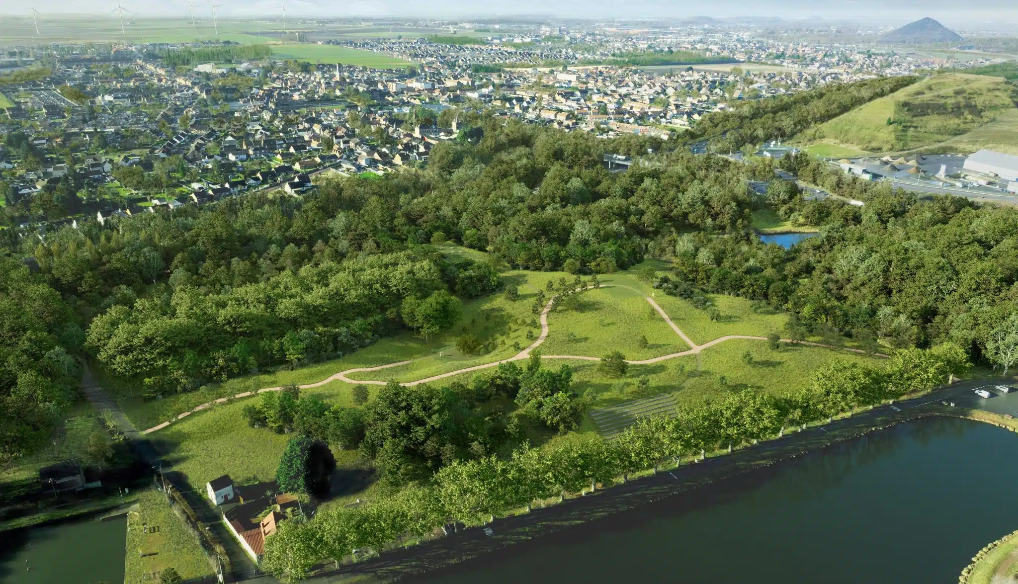
The quarry went from concave to convex; it got bigger and bigger, and turned into a hill - 'une colline'.

This hill became the highest in the Île-de-France region. With a summit elevation of 760 feet, all made up of the waste of a developing town, covered in earth, and then the earth covered in greenery.

It's the story of a hill that wanted to be a mountain. It decked itself out with an 'adret' and an 'ubac' (the different micro-climates of the north- and south-facing slopes of real mountains).

la colline d'Elancourt © Marie-Laure Garnier

The Colline d'Élancourt © Marie-Laure Garnier

Site d'ECT à Annet-sur-Marne © Marie-Laure Garnier

ECT site at Annet-sur-Marne © Marie-Laure Garnier

At Annet-sur-Marne, the valley rises up

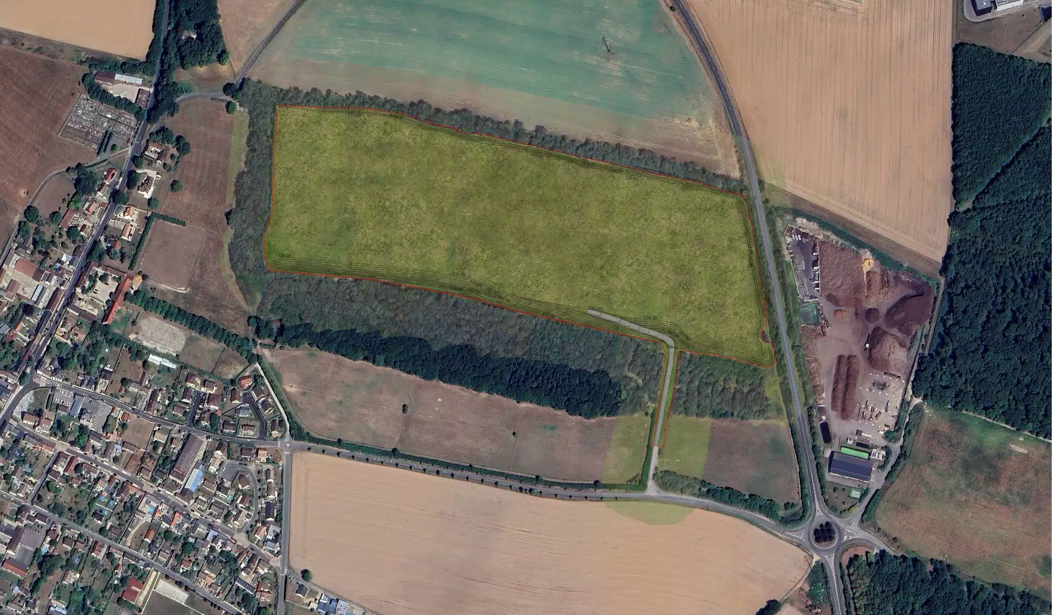
It's a valley that rises upwards. Unlike your average valley, sculpted by the erosive power of water which gullies and erodes its slopes. Here the earth rises up and installs itself, respectfully, around the electricity pylons.

It's very civil of the earth to avoid the feet of the pylons. The natural terrain they stand on will become, as the development of the ISDI (inert waste disposal facility) progresses, the future bottom of an artificial valley, its sides raised by successive landfills to form a new catchment area, guiding the water along its trough, encouraging wetland vegetation.

This is what's coming into existence, what exists already and is multiplying and being found on other sites. The interaction between electricity transmission lines and facilities for the disposal of inert soil creates an unprecedented dialogue in the landscape, in which the soil approaches yet avoids the pylons, creating ups and downs, sometimes windows or apertures in the rise of artificial hills. [...]

At Moissy-Cramayel, the fields are getting higher: The evolution of urban-rural landscapes

What we see here is the key to a movement in the evolution of landscape. Or how the big land-use development projects are creating a whole regional dynamic that is transforming the landscapes of the Île-de-France region.

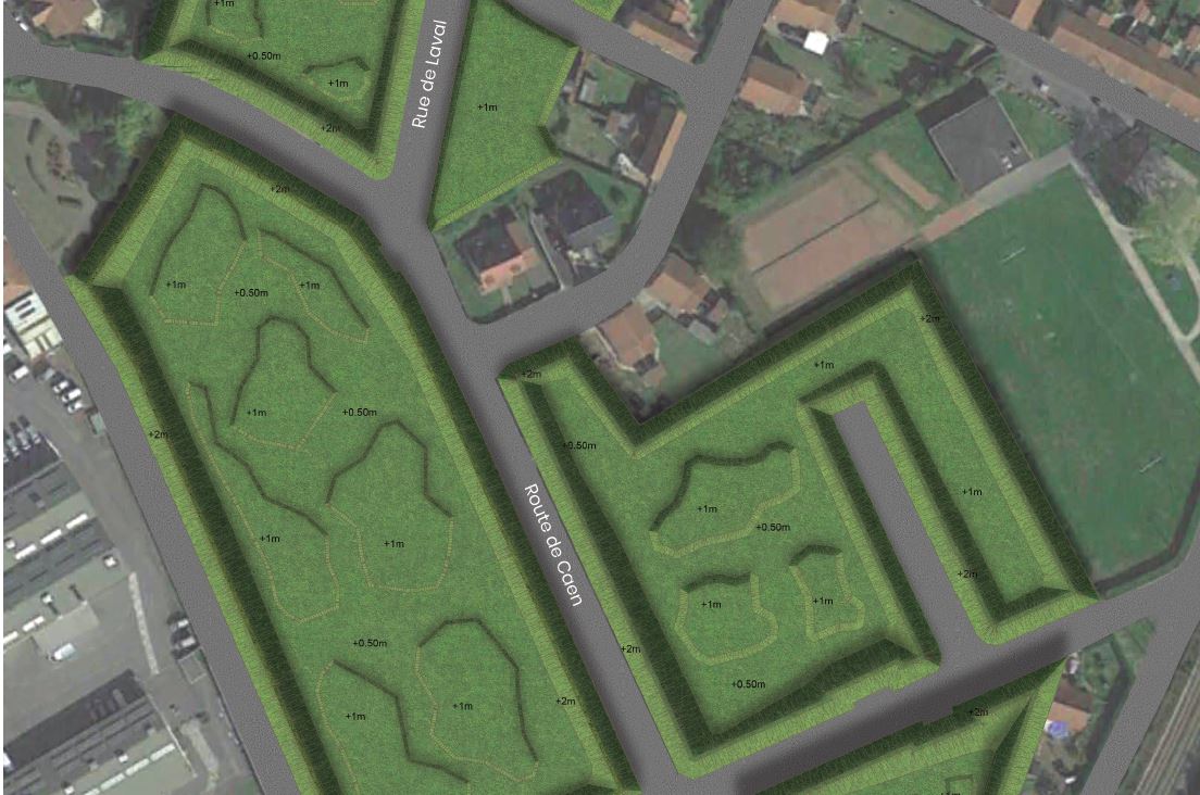
Infrastructure (highway, rail, etc) opens buffer zones in areas that might otherwise be suitable for building. Noise-protection bunds create acoustic protection around these areas by blocking noise pollution. Suddenly a place which was not suitable for building, such as farmland beside a road, becomes a possible site for urban development.

As the city grows, it expands over agricultural areas. Bunds, created by bringing in soil, offer acoustic protection for the new residents but also, paradoxically, a refuge for the fields… because you don't build on a bund. The soil is less compressed than on a natural site and does not guarantee adequate load-bearing capacity for house foundations. However, there is nothing to stop this inert made-ground from again forming fields, meadows, woods and other agricultural areas.

Changes to the topography or agricultural productivity of the soil (relating to the deposit of topsoil over many years and to bringing in spoil which may not have the same physical characteristics, the same PH or the same microfauna as the previous soil) may mean new uses or new methods of cultivation.

We may see livestock return to these slopes to improve the soil; we may see the return of tillage using draught animals to improve the load-bearing capacity of the soil. Bunds that are constructed today may, even more than being landscape amenities for the new populations living at their feet, be one of the few agricultural areas tomorrow within areas where land is in very high demand.

In these places, we'll have to wait and see.

Site d'ECT à Moissy-Cramayel © Marie-Laure Garnier

ECT site at Moissy-Cramayel © Marie-Laure Garnier

Site d'ECT à Forges © Marie-Laure Garnier

ECT site at Forges-les-Bains © Marie-Laure Garnier

Forges-les-Bains, where a valley turns into a hill

You can see from far away the belt of woodland that marks the edge of the plateau of the regional nature park of the Haute Vallée de Chevreuse.

The quarry, though, is hidden by rises and dips in the fields and by its own wooded surrounds.

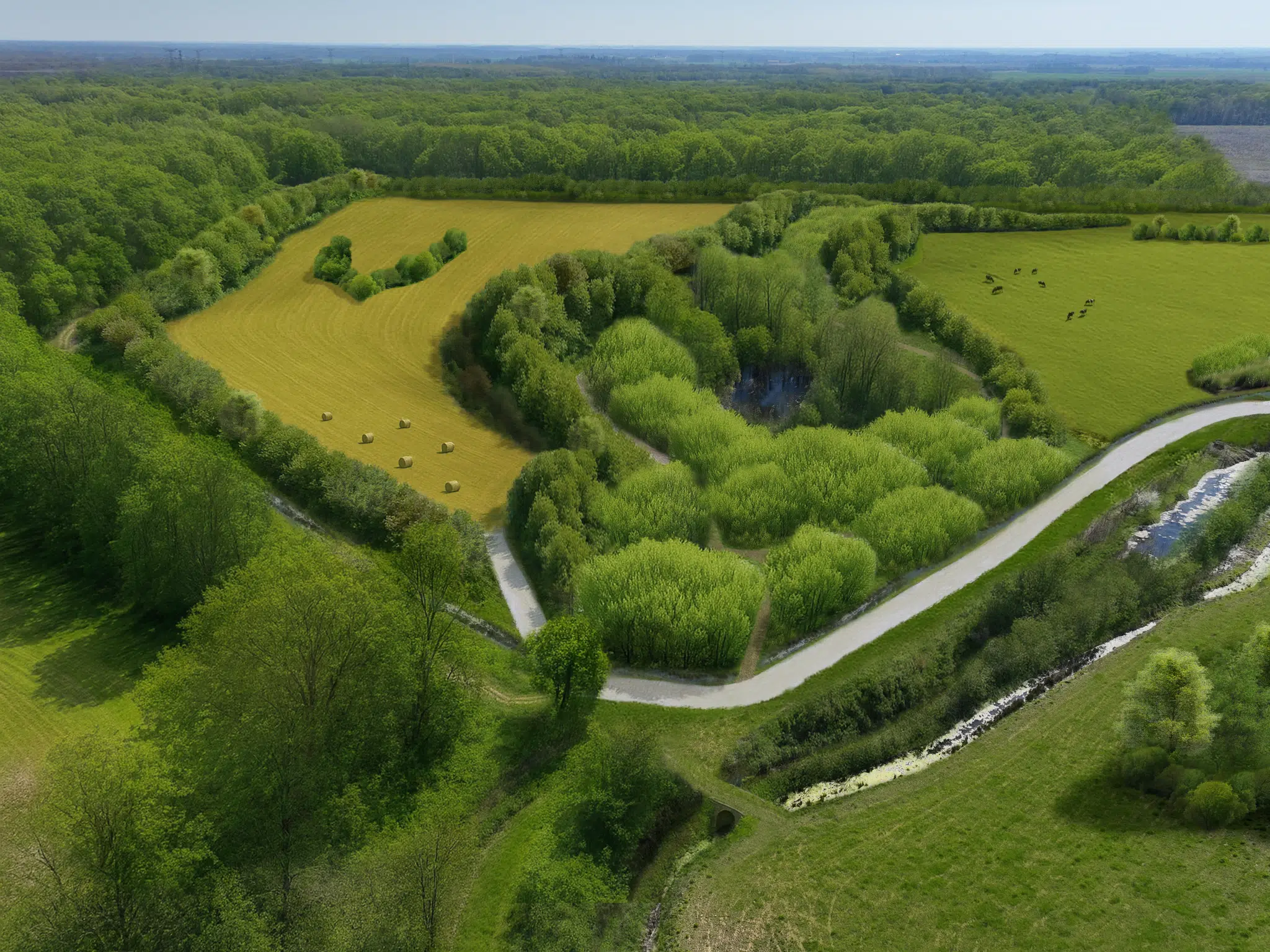
Before the soil was deposited here, there was a clay quarry for making firebricks. Through the diffuse mesh of trees, a rolling plain can be seen which, at its lowest points, forms a little valley with areas of open water lying on the surface. Various colours of earth, beige, brown and blue, blend into each other.

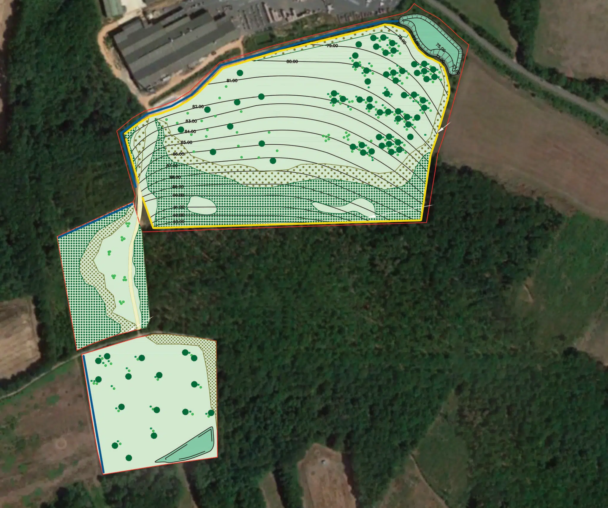
Orange markers, three feet above the ground we walk on, seem to show, like navigation buoys at sea, the future level of the earth. We are still beneath the ground. Don't think about it. Between the first application for development permission and the second, the project changed. The expected volume of soil increased, to the extent that the high point of today became the low point of tomorrow, and part of the valley turned into a mound.

On this site, water is a significant problem. On the edge of the site, a railway embankment carries a high-speed train line. At the foot of the embankment, water accumulates and risks making the embankment unstable. Currently, the water is constantly pumped away. ECT's future project on the site will attempt to solve this difficult equation.

X